For a record to be useful, we need an accurate location. A grid reference is a six-digit reference prefixed by a two-letter code. For example, SP 244 532. This reference is accurate to 100 metres.
Find grid references online
The quickest way to find a grid reference of a location is to go to the UK Grid Reference Finder and right click on the location – it’s that simple!
Find grid references with a paper map
Another way to find a grid reference is to use an Ordnance Survey map. To do that, you need to understand the National Grid.
For accurate grid references, use a 1:25,000 (4 cm to 1 km / 2 ½ inches to 1 mile) Explorer map (identified by their orange cover).
First part of a grid reference
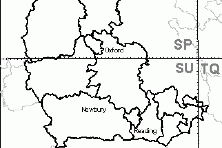
The Ordnance Survey divides the UK into 100 km squares. Each 100 km square has a two-letter code, which forms the first part of your grid reference.
In Oxfordshire and Berkshire, the codes are:
- SU (Berkshire and south Oxfordshire)
- SP (north Oxfordshire)
- TQ (easternmost part of Berkshire)

As an example grid reference, we will look at a location in the box labelled 'SP' in the figure 1 map.
Second part of a grid reference
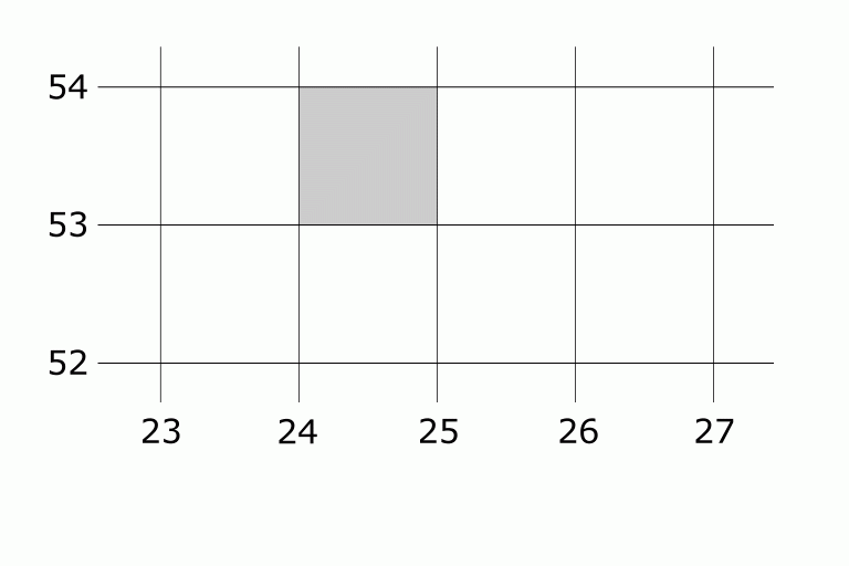
Each 100 km square is divided into 1 km squares - the lines you see on an Ordnance Survey map. Each one of these lines is labelled with two numbers (figure 2).

In our example (figure 2), the 1 km square we are looking at in is filled in.
To build the code for our example, find the following:
- the 100 km letter code
- the number of the vertical line running down the left-hand side of the 1 km square (the easting)
- the number of the horizontal line running along the bottom of the 1 km square (the northing)
For our example, we can see that the grid reference for the square is SP 24 53.
Third part of a grid reference
The next step is to work out the full six-figure grid reference.
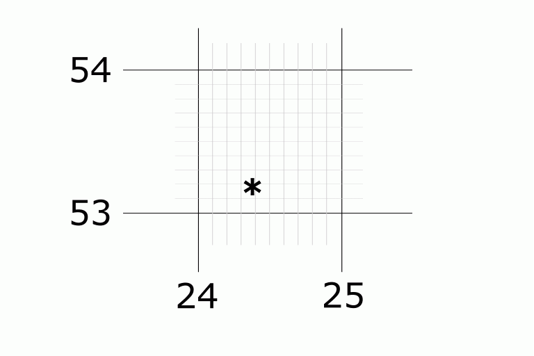
We subdivide the 1 km square into 100 m squares (figure 3). These subdivisions are marked but not numbered on the outside edge of a 1:25,000 Explorer map.

To get the final part of the reference:
- count the 100 m subdivisions to the east (right) of the nearest vertical 1 km line
- count the 100 m subdivisions to the north (above) of the nearest horizontal 1 km line
In our figure 3 example, the star is:
- four subdivisions to the east (of 24)
- two subdivisions to the north (of 53)
These numbers (4 and 2) form the third and sixth digits of your six-figure grid reference.
Combining all parts, our example grid reference is: SP 244 532.
Tips for recording the correct reference
Making mistakes with grid references, such as swapping the easting and northing numbers or providing the wrong two-letter reference, is quite common. However, grid references are easy if you keep the following tips in mind:
- Order matters: think of it as moving through a building. First, you go "along the corridor" (which corresponds to the easting value). Then, you go "up the stairs" (which corresponds to the northing value).
- Double-check: always verify the 100 km two-letter reference on your map.